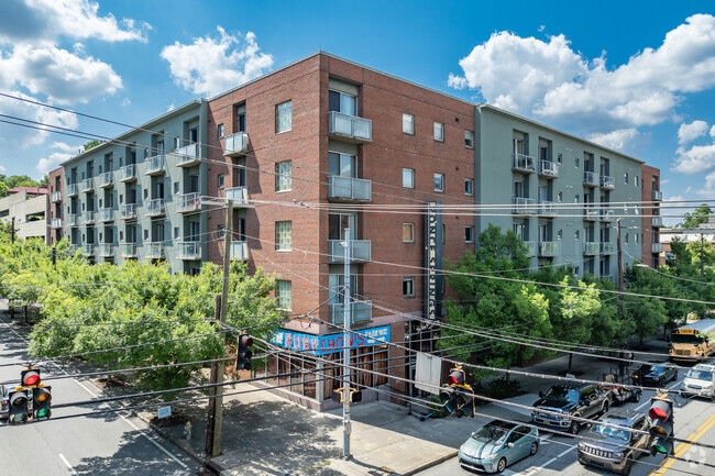
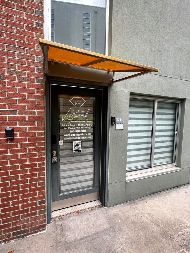
Property Record
620 Glen Iris Dr Ne, Atlanta, GA 30308
This Property Is For Sale
NEARBY LISTINGS FOR SALE OR LEASE
Property Detail
620 Glen Iris Dr Ne
Atlanta-Sandy Springs-Roswell, GA
Ponce Springs
14-0048-0012-068-8
Fulton
Condominium
Georgia
X
0.02 AC
13089C0063K
Old Fourth Ward
746 SF
Atlanta
DEMOGRAPHICS near 620 Glen Iris Dr Ne
1 Mile
3 Mile
5 Mile
2024 Total Population
35,571
195,828
424,178
2029 Population
36,702
202,057
436,699
Pop Growth 2024-2029
+ 3.18%
+ 3.18%
+ 2.95%
Average Age
36
35
37
2024 Total Households
20,664
97,495
199,679
HH Growth 2024-2029
+ 3.40%
+ 3.54%
+ 3.23%
Median Household Inc
$98,606
$93,261
$85,533
Avg Household Size
1.60
1.80
1.90
2024 Avg HH Vehicles
1.00
1.00
1.00
Median Home Value
$579,254
$559,494
$482,245
Median Year Built
1994
1997
1990
Nearby Places
Map Layers
Map Styles
 Street
 Aerial
- Restaurants
- Banks
- Shops
- Fitness
- Groceries
PUBLIC TRANSPORTATION
COMMUTER RAIL
Atlanta (Crescent - Amtrak)
DRIVE
WALK
Distance
Atlanta (Crescent - Amtrak)
7 min
3.8 mi
AIRPORT
Hartsfield - Jackson Atlanta International
DRIVE
WALK
Distance
Hartsfield - Jackson Atlanta International
19 min
11.4 mi
Freight Ports
Georgia Ports - Savannah
DRIVE
WALK
Distance
Georgia Ports - Savannah
282 min
250.7 mi
Nearby Properties
Address
Land Use
TOTAL SIZE
Lot Size
Zoning
Address
Land Use
TOTAL SIZE
Lot Size
Zoning
19.94 AC
SPI1
Address
Land Use
TOTAL SIZE
Lot Size
Zoning
1,585,451 SF
1.97 AC
SPI2
Address
Land Use
TOTAL SIZE
Lot Size
Zoning
2,283,599 SF
12.93 AC
I1
Address
Land Use
TOTAL SIZE
Lot Size
Zoning
9.80 AC
C5
Address
Land Use
TOTAL SIZE
Lot Size
Zoning
179.40 AC
R4
Address
Land Use
TOTAL SIZE
Lot Size
Zoning
3.16 AC
SPI1
Address
Land Use
TOTAL SIZE
Lot Size
Zoning
9 AC
C5
Address
Land Use
TOTAL SIZE
Lot Size
Zoning
10.27 AC
C5
Address
Land Use
TOTAL SIZE
Lot Size
Zoning
1,039,831 SF
0.31 AC
C4
Address
Land Use
TOTAL SIZE
Lot Size
Zoning
1,227,912 SF
2.15 AC
SPI4
Address
Land Use
TOTAL SIZE
Lot Size
Zoning
1,736,017 SF
3.63 AC
SPI2
Address
Land Use
TOTAL SIZE
Lot Size
Zoning
1,300,309 SF
4.81 AC
SPI1
Address
Land Use
TOTAL SIZE
Lot Size
Zoning
1,434,872 SF
1.89 AC
SPI1
Address
Land Use
TOTAL SIZE
Lot Size
Zoning
61.57 AC
C5
Address
Land Use
TOTAL SIZE
Lot Size
Zoning
1,116,157 SF
1.48 AC
SPI3
Address
Land Use
TOTAL SIZE
Lot Size
Zoning
1,467,469 SF
0.07 AC
C4
Address
Land Use
TOTAL SIZE
Lot Size
Zoning
903,671 SF
1 AC
C3
Address
Land Use
TOTAL SIZE
Lot Size
Zoning
10,954,869 SF
28.88 AC
C3
Address
Land Use
TOTAL SIZE
Lot Size
Zoning
1.55 AC
SPI1
Address
Land Use
TOTAL SIZE
Lot Size
Zoning
1,646,011 SF
3.74 AC
SPI4
Address
Land Use
TOTAL SIZE
Lot Size
Zoning
7 AC
C3
Address
Land Use
TOTAL SIZE
Lot Size
Zoning
342,275 SF
0.70 AC
SPI3
Address
Land Use
TOTAL SIZE
Lot Size
Zoning
903,732 SF
0.34 AC
SPI1
Address
Land Use
TOTAL SIZE
Lot Size
Zoning
467,847 SF
1.62 AC
I2
Address
Land Use
TOTAL SIZE
Lot Size
Zoning
1,314,183 SF
2.61 AC
SPI1
Address
Land Use
TOTAL SIZE
Lot Size
Zoning
2,577,342 SF
2.04 AC
SPI1
Address
Land Use
TOTAL SIZE
Lot Size
Zoning
1,356,182 SF
2.52 AC
SPI4
Address
Land Use
TOTAL SIZE
Lot Size
Zoning
2,612 SF
137.60 AC
X
Address
Land Use
TOTAL SIZE
Lot Size
Zoning
1,121,700 SF
2.21 AC
I2
Address
Land Use
TOTAL SIZE
Lot Size
Zoning
13,340,229 SF
3.68 AC
SPI1
The World's #1 Commercial Real Estate Marketplace
Connect with us
© 2025 CoStar Group
The information above has been obtained from sources believed reliable. While we do not doubt its accuracy we have not verified it and make no guarantee, warranty or representation about it. It is your responsibility to independently confirm its accuracy and completeness. Any projections, opinions, assumptions, or estimates used are for example only and do not represent the current or future performance of the property. The value of this transaction to you depends on tax and other factors which should be evaluated by your tax, financial, and legal advisors. You and your advisors should conduct a careful, independent investigation of the property to determine to your satisfaction the suitability of the property for your needs.